So you’re going to be visiting Boston and want to know the best way to get around the city. Luckily, Boston is such a compact city with many of its most popular sites and attractions contained within an area that’s only about one mile wide and three mile long.
I’ve put together this Ultimate Guide to Getting Around Boston and Beyond to highlight the many transportation options available to help you get to where you want to go in and around Boston.
- Walking in Boston
- Biking in Boston
- Ride Shares and Taxis
- Boston’s Public Transportation (MBTA)
- Amtrak Train
- Ferry and Water Shuttles
- Driving in Boston
- Parking
- Getting to and from Logan Airport
Walking in Boston
Boston is such a walk-able city. In fact, it has been named one of the most walk-able cities in the US. But really, what does that mean? What one person thinks is walk-able may not be for someone else.
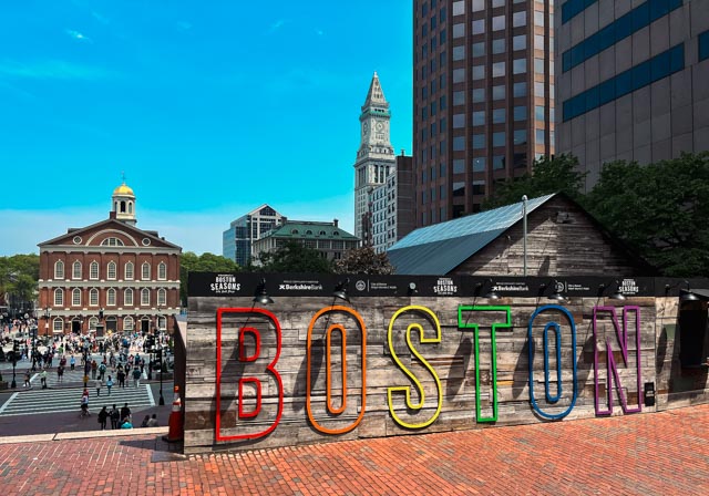
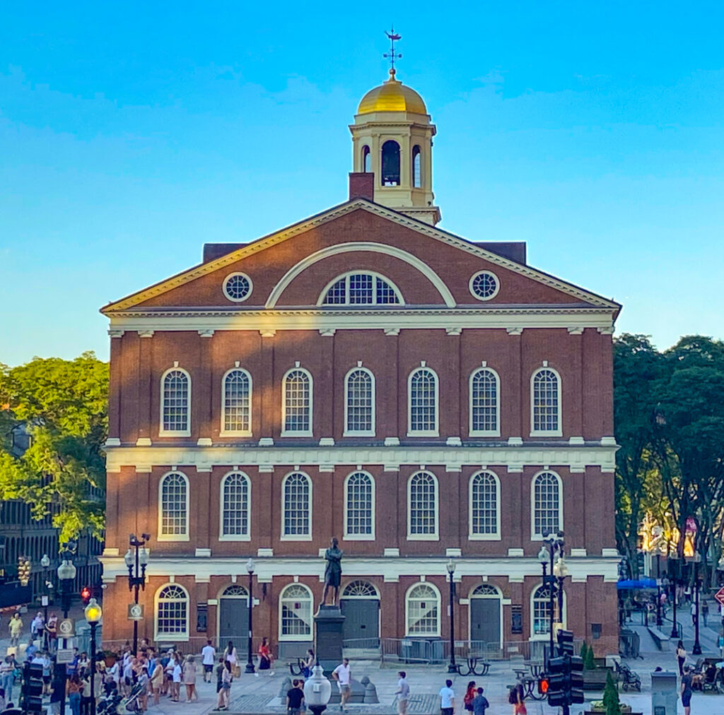
To give you an idea of how much ground you will need to cover walking around the city, we’ll use the Faneuil Hall Visitor Center as a starting point. From there, we’ll see how long it takes to walk to some of Boston’s most popular neighborhoods and attractions.
From Faneuil Hall, you can walk to these locations in about 20 minutes or less:
- Boston’s Waterfront
- New England Aquarium
- The North End
- TD Bank Garden
- Boston Common
- Boston Public Garden
- Boston Tea Party Museum
- Boston’s Seaport area
- Boston Children’s Museum
- South Station
- Chinatown
- Theater District by way of Tremont Street
From Faneuil Hall, these locations will take longer than 20 minutes to walk to so you may want to take alternate transportation.
- Museum of Science
- Copley Square
- Charles River Esplanade and Hatch Shell
- Charlestown Navy Yard (consider taking the MBTA Ferry from Long Wharf)
- Prudential Center
- Boston’s South End
- Fenway Park
- Museum of Fine Arts
- Isabella Stewart Gardner Museum
Walking around Boston is a great choice but sometimes you will need a different option. The weather may not be good, the distance may be too far, or you’re just not up for walking. In that case, try one of the following alternatives.
Biking
If city biking is your thing, then you’re in luck. Over the last few years, Boston has had an initiative to improve bike lanes and has a great bike share program called “Blue Bikes” where you can rent bikes throughout the city.
There are over 200 Blue Bike stations around Boston and surrounding cities like Cambridge so you will surely see them in all the popular neighborhoods. You can rent the bikes at the kiosk or by downloading the app.
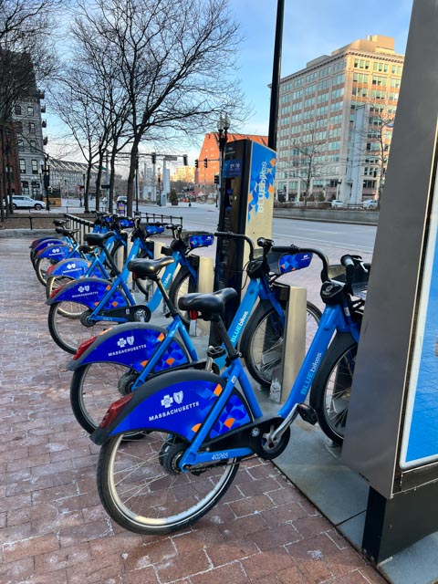
For single rides you pay $2.95 for the first 30 minutes and $2.50 for each additional 30 minutes.Once you get your bike, you can explore the city and return it to any Blue Bike station across the city when you are done.
As you make your way around the city, you’ll notice there are lots of bike lanes and Boston drivers are typically used to sharing the roads with bicyclists. Be sure to visit the City of Boston’s website for everything you need to know about biking in Boston.
Ride Share (Uber/Lift)
Ride share options like Uber and Lyft are a great way to get from point A to point B quickly. Usually they are less expensive than taxis and ultra convenient since you can pay directly from the app on your mobile phone.
What I love about using the ride share apps is that you can track your assigned driver to know when they will arrive and you will know exactly how much the ride will cost. You will also see a photo of your driver and the car’s make/model and license plate number so you can verify you are getting into the correct car.
Insider Tip: Be sure to download the respective ride share app and set up the payment method before you arrive if you don’t already have it installed. That way, when you need a ride all you need to do is select a car size, your pickup/dropoff location and you will be assigned a driver.
Taxi
While you may easily find a taxi at the airport or some of the more popular hotels and attractions, it is not as easy to hail a cab in Boston as it is in New York. If you are looking for a taxi and can’t find one, try walking to the nearest hotel and you may be able to find one there or ask for a reputable taxi company.
Typically, taxis are more expensive than ride share options but if one is readily available and you don’t want to wait for a ride share it may be worth jumping in. I tend to stress when using a taxi if there is not a fixed fee, especially during rush hour traffic.
Massachusetts Bay Transportation Authority (MBTA)
Boston’s public transit system, the MBTA, provides a network of water, bus, and rail routes making it a great way to get around the city. It is the oldest public transit system in the United States and according to their website, the subway tunnels that run under Boston Common are the first ones used in the country.
The MBTA has an interesting history, dating back to the 1600’s and has evolved from horse and buggy to its present day service which shuttles over a million riders daily on its subways, buses, ferries and commuter rail lines.
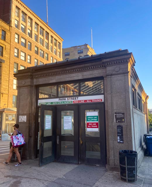
What is the “T”?
As you begin to make your way around the city, you’re sure to see subways stations along the way. Known to locals as the “T”, the subway runs throughout Boston, into Cambridge and some nearby suburbs. Just look for the big “T” in a circle to find a stop.
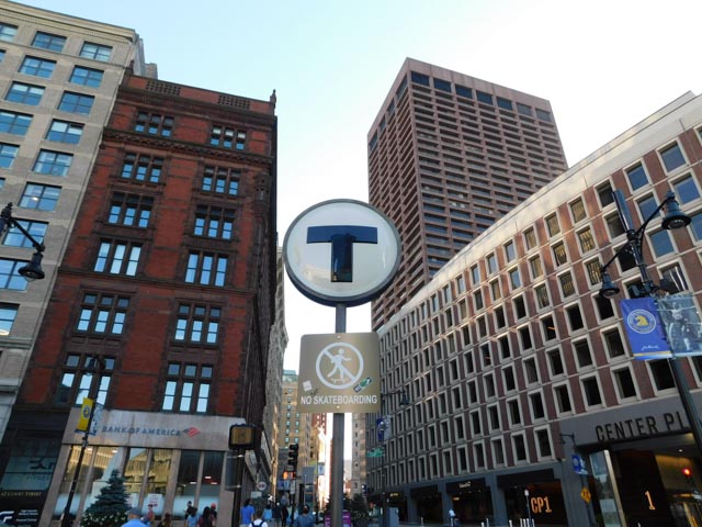
The rail lines are color coded.
- The Red, Orange, and Blue Lines are the most commonly used and comprise the underground portion of the line.
- The Green Line operates on four branches—B, C, D, and E.
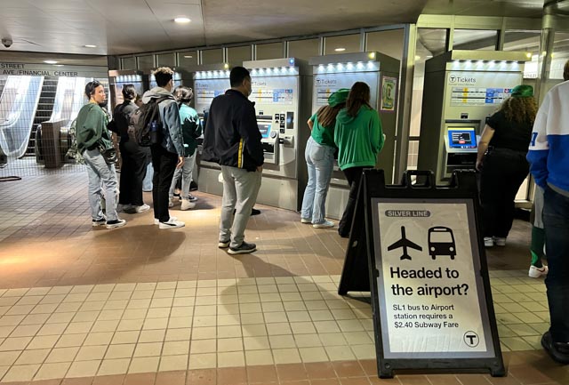
- The Silver Line provides bus transportation, mainly to and from the Airport.
Riding the T like a local is an experience. As one of the oldest public transportation systems in the country it is not the smoothest so plan to hang on!
Insider Tip: If you are considering using this line, be sure to check the schedules as ongoing improvements may impact its schedule, operation or availability.
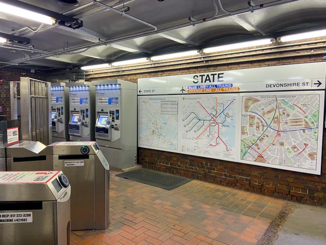
How much does it cost to ride the T?
To ride the T you need to purchase a Charlie Ticket which is $2.40 each way. A Charlie Card One Day Pass is and a week pass is $22.50. Be sure to visit mbta.com for the most up-to-date fares.
Insider Tip: Starting in 2022, changes in new contactless payment options will be introduced on the MBTA. By 2024, Insertable CharlieTickets will be discontinued and replaced with the new, tappable CharlieTickets across the system.
Where does the T stop?
Check out the MBTA Boston Visitor Guide which will help get you to where you want to go.
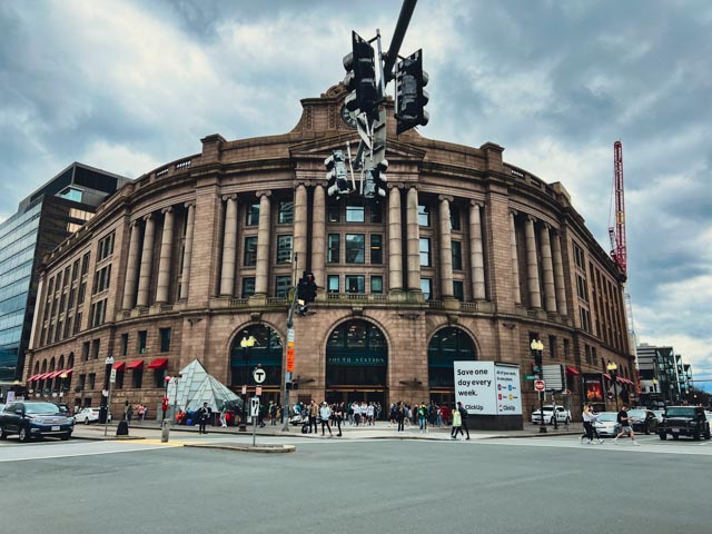
MBTA Commuter Rail (The Purple Line):
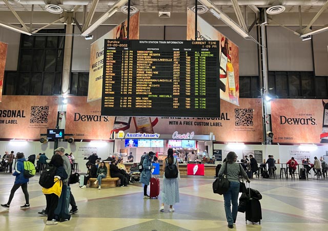
The Commuter Rail reaches destinations further outside of Boston and runs out of two hubs: North Station and South Station.
Use North Station if you are going to destinations in the west or north like Concord (Fitchburg Line) and Salem (Newburyport/Rockport Line).
Use South Station if you are heading towards South Shore or Providence, RI (Providence/Stoughton Line).
The Commuter Rail line does not run as frequently as the subway and ongoing improvements may impact its operation. Be sure to check the schedules if you decide to use this line.
Important: Be aware that many Commuter Rail stations are not typically walking distance to popular attractions so plan accordingly. One exception would be taking the Newburyport/Rockport line to Manchester-by-the-Sea if you want to visit a beautiful beach on the North Shore. Singing Beach is just a 10-minute walk from the station.
Amtrak Train
Amtrak runs train service out of three T stations:
- South Station (700 Atlantic Ave)
- Back Bay Station (145 Dartmouth Street)
- North Station (On Causeway Street, under the TD Bank North Garden
Amtrak Trains leaving North Station only travel the Downeaster route with daily round-trips between Boston, MA and Brunswick, ME. All other Amtrak services in Boston depart from South Station and Back Bay Stations.
Ferries and Water Taxis/Shuttles
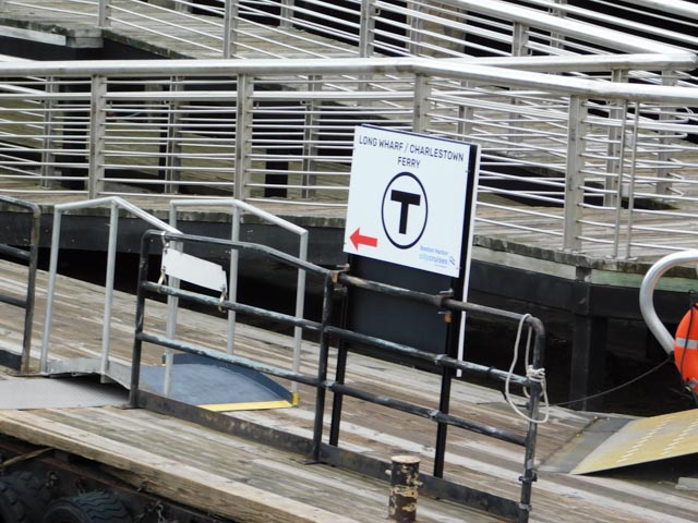
Getting out on the water is always fun and there are several options to get you around Boston by Ferry or water shuttle. The MBTA offers year round Ferry service to the Charlestown Navy Yard, Logan Airport, Hingham and Hull. Seasonal service (May-Oct) is provided to Salem and Provincetown.
There is also a complimentary water shuttle between Long Wharf and the Encore Casino in Everett.
Driving in Boston
Driving in Boston is definitely not for the faint of heart. My best advice here is DON’T, unless you absolutely, positively need to – especially during peak times.
My top 3 reasons for not driving in Boston.
- For starters you will sit in traffic, especially during peak travel times which will be very frustrating. If you have limited time in Boston, you don’t want to waste precious time stuck in your car when you could be seeing the sights of Boston.
- Driving in Boston can be quite confusing if you don’t know where you are going. There are lots of one-ways, the traffic patterns are not intuitive and some streets are very narrow, especially in the North End.
- Parking is expensive and can be hard to find – especially during peak travel times.
Insider Tip: If you plan to rent a car to visit some other parts of Massachusetts or New England, wait until you are ready to leave Boston before picking up your rental car so you won’t have to pay for parking. Most hotels do not offer free parking so you will need to park it in a garage or lot.
Parking
If you do end up driving into Boston you will need to find somewhere to park. Be prepared to pay a hefty fee when parking, especially if it’s game day or an event is happening close to where you are trying to park. Most garages charge $30-40 per day. On game or event days, that could be as high as $50 or more around the TD Garden or Fenway areas. Pretty insane right!
How can I get Discounted parking?
- Be sure to check to see if your hotel or attraction validates parking for a discount.
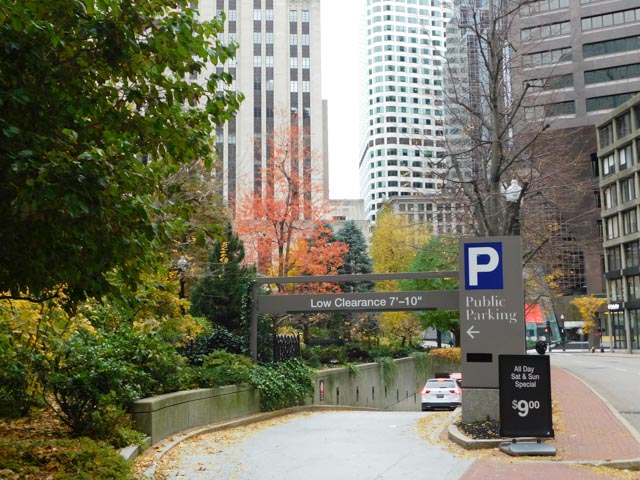
- In some areas, you may find reduced parking fees for nights and weekends. The Garage at Post Office Square in the Financial district is one of my favorites. It is a good location for walking to several of the popular tourist neighborhoods and is only $9.00 all day Saturday and Sunday. Since the Financial District is very quiet during the weekend be aware of your surrounding to be safe.
- Get discounted parking at 75 State Street if you are going to Faneuil Hall
- Purchase your ticket before you arrive at sites like ParkWhiz or Spot Hero app
Street Parking
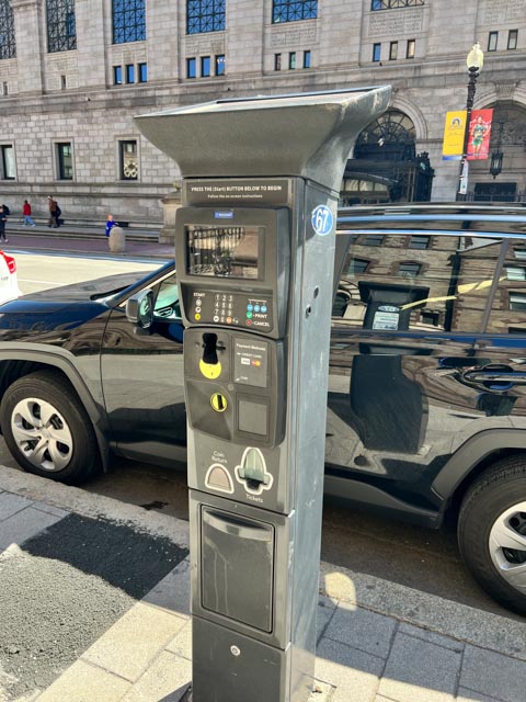
Throughout the city you will see metered parking on the street and are active between 8:00AM and 8:00PM (except Sundays and Holidays). The cost per hour varies depending on what part of the city you are in but generally it is between $2.00-$4.00 an hour.
Metered parking typically has a 2 hour limit which is strictly enforced. Be aware that in many neighborhoods, street parking is restricted to residents only. Beware that getting a ticket for an expired meter or for parking in resident spaces can be expensive.
Insider Tip: On Sundays, metered parking is completely FREE! This applies to metered spaces but NOT where resident parking is marked. Be sure to read the signs when parking on the street.
Getting to and from Logan Airport
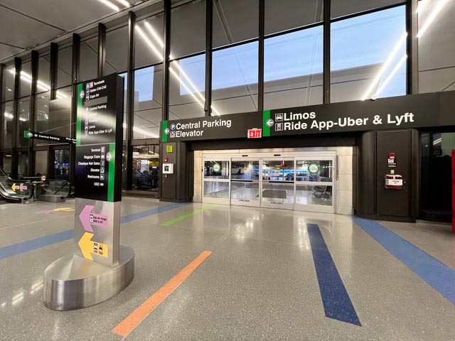
If you are arriving from Logan Airport you have several options to get to your Boston destination if your hotel does not provide transportation.
The easiest option may be to grab a Ride share or Taxi by heading to Ground Transportation. Massport also offers several Transportation Options for getting to and from Logan Airport.
If you are staying near Boston’s Waterfront there is a MassPort water shuttle that provides direct service between Rowes Wharf and Logan Airport. A shuttle bus is also available from the Logan Dock to all terminals.
Rush hour traffic can add a significant amount of time to your trip so plan accordingly – especially if you are heading back to the airport to catch a plane.
The Bottom Line
As you can see there are many options available for getting around Boston. My preference is walking whenever possible so I can explore what the city has to offer up close and personal.
MBTA:
- mbta.com for the most up-to-date fares
- View a map of the T system
- View the Commuter Rail Map
- View Ferry Fares
Airport:
Note: This information was accurate when it was published. Please be sure to confirm all rates and details on services before planning your trip.
Explore More…